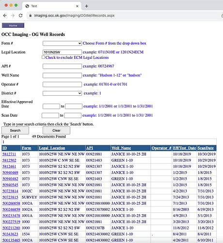
Oops. I was off. I typed in 4 instead of 10 into my query. (Caught the SW 4 out of the corner of my eye) Ignore those wells above. You have the Green and Janice wells instead. Use the OCC OGwellrecords site to hunt them down. The 1073 form shows the operator changes. BCE-MACH II LLC owns the wells now.
You probably only own a portion of the 160 acres as it would be very rare these days to own the whole quarter section due to generational fractionation. The leases often use the gross parcel numbers but the net acres are usually less. There are at least 114 owners in the section.
The spacing of the gas wells and the horizontal wells covers all 640 acres so “without any production” is not relevant here.
