My wife is co leasser (64 others) of 361 acres in Clay distsrict, 8 years ago she received $500.00 and papers to sigh from Chevron. Pays taxes annually and never receives any update on plans for the lease. Such a small part of ownership, investors don’t want to purchase and at age 84 would like to know status before trust is established. Thanks
Paul_gill,
Unfortunately I would need some more information about the mineral interest in order to get you the information that you have requested. I’m not sure what you feel comfortable to share online. You can always contact a professional like myself to help.
With all of the trading of mineral leases between companies, there is a good chance that Chevron has traded/sold the rights to someone else. You could always start by contacting Chevron directly.
It is a buyers market right now, I am sure there are some buyers out there interested. They might not pay a lot, but I am sure they are out there.
Hope this helps!
~Rachel
What information about the mineral interest would a “land man/lady” need to research. Very vague interaction with lease holders… Chevron over the years is very vague to an unknowledgeable lease holder… many of the original 64 share holders and Chevron has not responded to obiutuaries to remove those persons… typical confusion of corp America… wait them out and continue the confusion.
How small of an ownership in the 361 acres?
If you’re able to post the tax parcel ID numbers that the lease covers that would be helpful
Mr Gill, I took the liberty to look up the Gill name on the Marshall County website and there are several entries for Carol Gill regarding various lease documents. Try going to the website marshallcountywv.gov and select County Clerk’s Office then in the right upper corner select Click Here for online documents. A page will appear with a button for Individual. Type in Gill in the last name block and hit enter. Numerous documents should display and you can individually view them. There is one for a lease in Clay Co for .56 ac dated 8/31/2010. A more recent document of the 4th Amended Consolidation of Oil & Gas Leases dated 04/07/2020 has Carol Gill listed. Hope that helps.
Glenda Gill is the partial owner I am referring to. Map/Parcel: 9999 0000 3348 0040, property description is INT IN 134.45 A O&G LEASED. Glenda pays tax on this described lease annually. We don’t know within Clay district, Marshall county this lease is located and Chevron nor EQT either know where it is or don’t want to disclose location. Very frustrating. In 2017 there were 64 owners, some of those are now deceased, however the list hasn’t been updated in years. Again, Glenda has no heirs, other than me, her husband, this shouldn’t be left “hanging” after she is gone…
There’s plenty of investors out there willing to buy small tracts or these types of interests especially in Marshall county. Contacting someone like Rachel to evaluate what you have would be a great idea. I know a ton of ppl buying minerals so if its about selling you can easily at least get offers
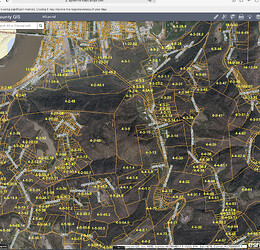
Mr Gill, I did a bit more research and found your wife’s lease and the parcels listed in the lease. The lease is on the marshallcountywv.gov site, County Clerk’s Office in book 811 @ page 421. In the lease it refers to your wife’s parcels as 4-3-8, 129.450 ac and 4-3-7, 5 ac totaling the 134.450. The lease is dated 10/9/13. The parcels are located just south of Moundsville. You can view them on the Marshall County GIS site. Also in book 1072 @ page 609 is a DPU of the Hicks North Central East Unit Third Amendment dated 1/21/20 in which your wife is listed with 12.696 ac in the unit. There appears to be 3 permitted but not yet drilled wells crossing your property. Their API numbers are 47051021630000, 47051021640000 and 47051021650000. On the dep.wv.gov site on the Weekly Reports page you can further research the individual wells using the Application Xtender program listed on that page. I know there is uncertainty regarding Chevron’s ownership in these permitted wells. You might try calling the WV DEP Oil & Gas Office @ 304 926-0450 and see if they can help. Hope that helps.
This topic was automatically closed after 90 days. New replies are no longer allowed.
