My brothers and I are new to this too. Lost our parents, inherited some land and been offered a lease. What is current appropriate signing bonus per acre in Stephens Co. 1-1S-5W? I see from posts the 3/16ths royalty is standard and to include a few key clauses in lease but would sure appreciate advice from anyone knowledgable of pricing and what's going on in this area. What is a good price per acre? Are prices going up? Anything we need to be careful of? And does anyone have or be able to tell me where to go to find a current oil and gas map of the area? Would that give us an idea of activity. Thank you so much. I would sure appreciate any help, guidance, info you can give us! And apparently we need to answer quickly so would appreciate response as soon as possible. Thanks so much! Dee
I purchased my Carter County area map from the company below. The cost was $80.00 Be sure to ask how current the map is. Also you will not want all the Stephens County as it would cost too much.
http://www.p2energysolutions.com/tobin-map-data/superbase/well-locations
If this is your first lease offer, just wait, there will be more if there really is something down there. Try to get more royalty say 1/4 for half of the bonus or 1/5 for zero bonus.
Dee, Continental Resources recently did a presentation on what they are calling "The Scoop". Click the link below to see the slide show. Looking at the map of the scoop 1S/5W is in the NE 1/4 of Stephens County about 12 miles south and 6 miles west of the county lines.
http://media.corporate-ir.net/media_files/irol/19/197380/CLR_Sunday_10_7_12_Anadarko_Woodford_3.pdf
thank you Michael! I looked at the slide show. Wish I understood it! How recent was this presentation..do you know. Because it looks like they are very active in the area...so that would indicate that they are more interested in getting our lease and that there is activity...rather than what they are saying...that its kind of a dead zone??
I read the complete presentation and found STACKED LATERALS to be of interest. The Volumtrics report for the Woodford Shale in my area is 330' thick.
I don't know what all that means in the presentation. stacked laterals etc....
Just trying to figure out what the fair price is per acre on a 3 year lease. I know it depends on whether the area is thought to be valuable for drilling. I don't know what all those slides mean..except it looks like there is something there that they want to go after. I don't think they would be coming to us if there weren't something interesting or possible. We are not trying to be greedy at all...just trying to understand a little more about a complex business that we really have very little knowledge of. That is why I'm reaching out...hoping you all that do understand can tell us in "lay" language what is fair. Thanks again.
and could one of you folks tell me what "pooling" or a "pooling clause" is? Thanks
Dee, They wouldn't want to lease if it was a dead zone. Continental is the real deal and Jackfork usually represents them when they are seeking to obtain acreage. At times you could be be approached by speculators who will "flip" your lease for a good profit.
Pooling is when a company like Continental is preparing to drill but some mineral owners have not signed or not been located, they can apply for Forced Pooling. It is not as bad as it sounds as many times that is when the highest lease bonus amounts are paid. It is a gamble because there is always a chance plans will change and pooling never takes place. If you don't want to take that risk try to negotiate for a better deal they will have some wiggle room. I saw you asked Rick Howell about this, he is very well informed and will give you good advice.
Thank you so much Michael. I really appreciate your explanation. Is your take on that presentation you sent the link to that Continental sees some really good potential for the area my brothers and I are in in Stephens County? I really don't know what all those things are in the slides...can you help me explain it to my brothers? I hope to hear from Rick Howell. Maybe he is visiting family for Thanksgiving and not checking his emails/forum? Happy Thanksgiving!
The OCC (Oklahoma Corporation Commission) website is a free site where you can search permits to drill, existing wells and plugged wells. They have instructions to help walk you through it.
I don't know of a current map unless you subscribe to DrillingInfo.com and that's rather expensive.
Dee, The presentation was for the benefit of CLR shareholders and they always make those things look as good as possible to pump up investor confidence. In this case it did a pretty good job of pumping up royalty owners too!
I am fortunate enough to be one of the royalty owners in the first well in the Stephens County part of the scoop. We are excited now about the possibility of additional wells being drilled in our section.
Our well was completed in Feb 2012, today 20 out of the 36 sections in 2N/4W are being drilled or at some point in the process of preparing to drill. You are in the same range 4W but you are 2 townships south of us, so you are roughly 12-15 miles south of us. That is not very far so my best guess is the trend will continue south. How long that takes I haven't a clue. If you and others sign a 3 year lease they will most likely drill before that 3 years is up if the area still looks promising.
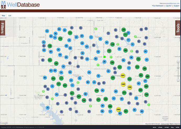
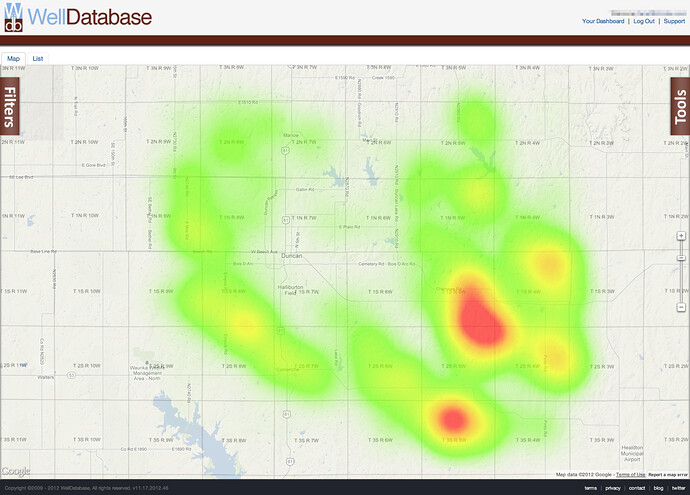
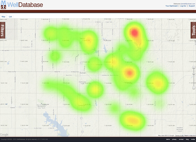
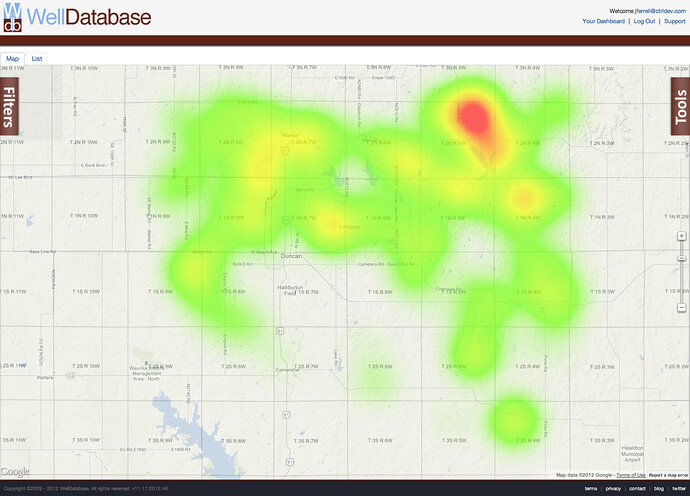
Here are a few maps of Stephens County. Each of the maps below show all of the wells ever drilled in the county. You can follow the link below and interact with the map yourself if you'd like
https://app.welldatabase.com/browse/well/public/sJ7d0
Overview of the county:
Same view except as a heat map showing the well density
Oil production heat map
Gas production heat map


