I own mineral rights in the entire western half of a section square. Almost dead center of the square is a plugged and abandoned well, if anything it looks to actually be on land that I have interest in, but it is hard to tell. However, there are five (possibly 7) wells that on the MineralQ map appear to be directional wells that end at the abandoned one. Two are above the area that I have interest in, but the other 3 (5) are on the eastern half. One even has the same name as the abandoned one. Is there a way to see if these other wells should be paying me as well?
Forum members can help you better if you give the state. county and the section, township and range or abstract number.
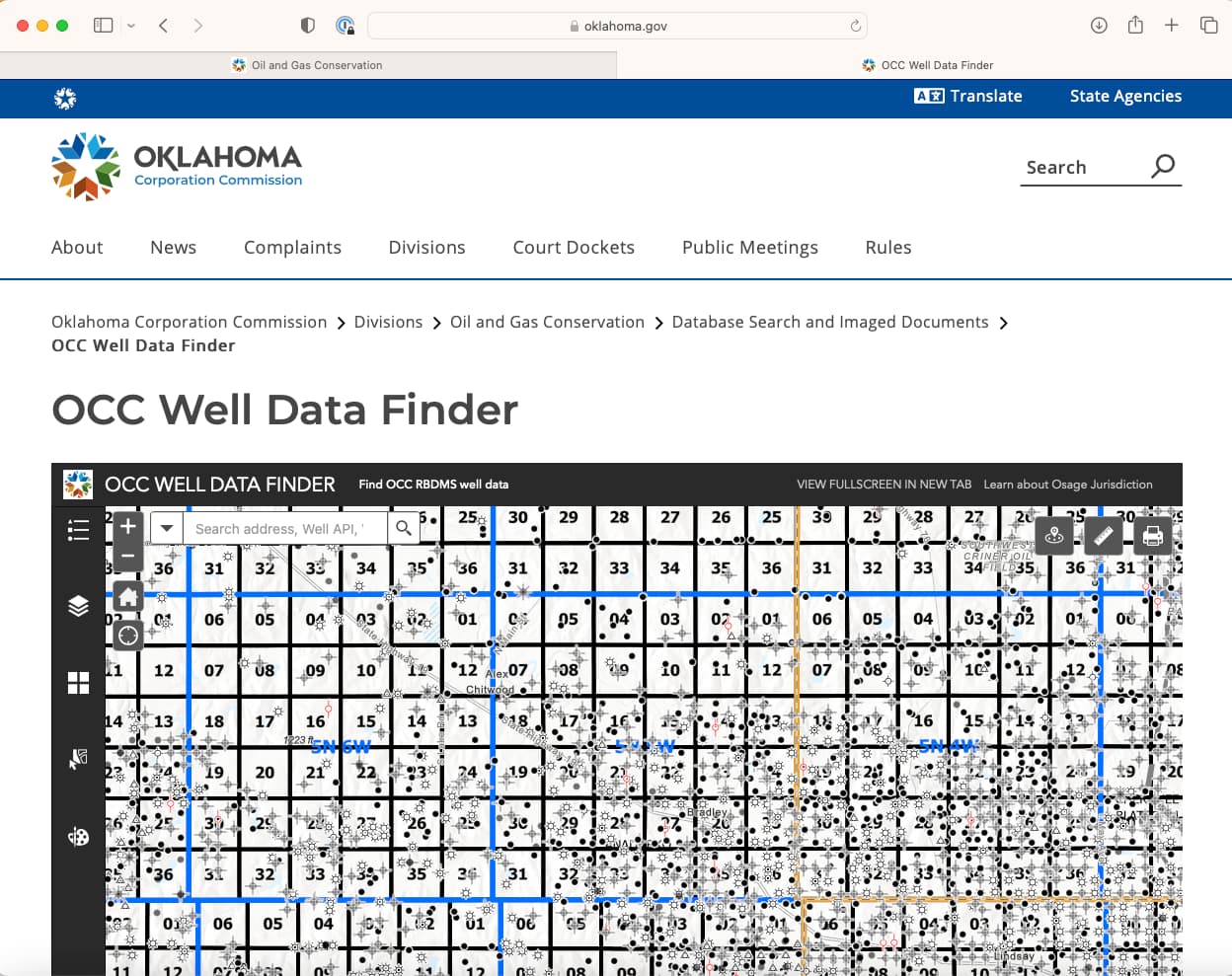
Section 25 township 5N range 5W Grady county OK
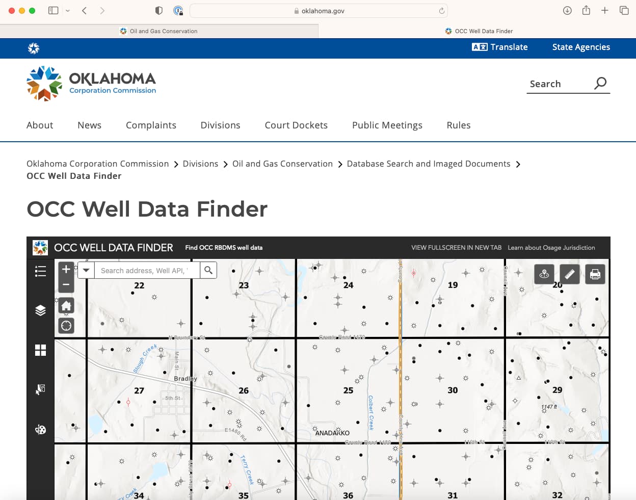
use the OCC well data finder map. Then zoom in…
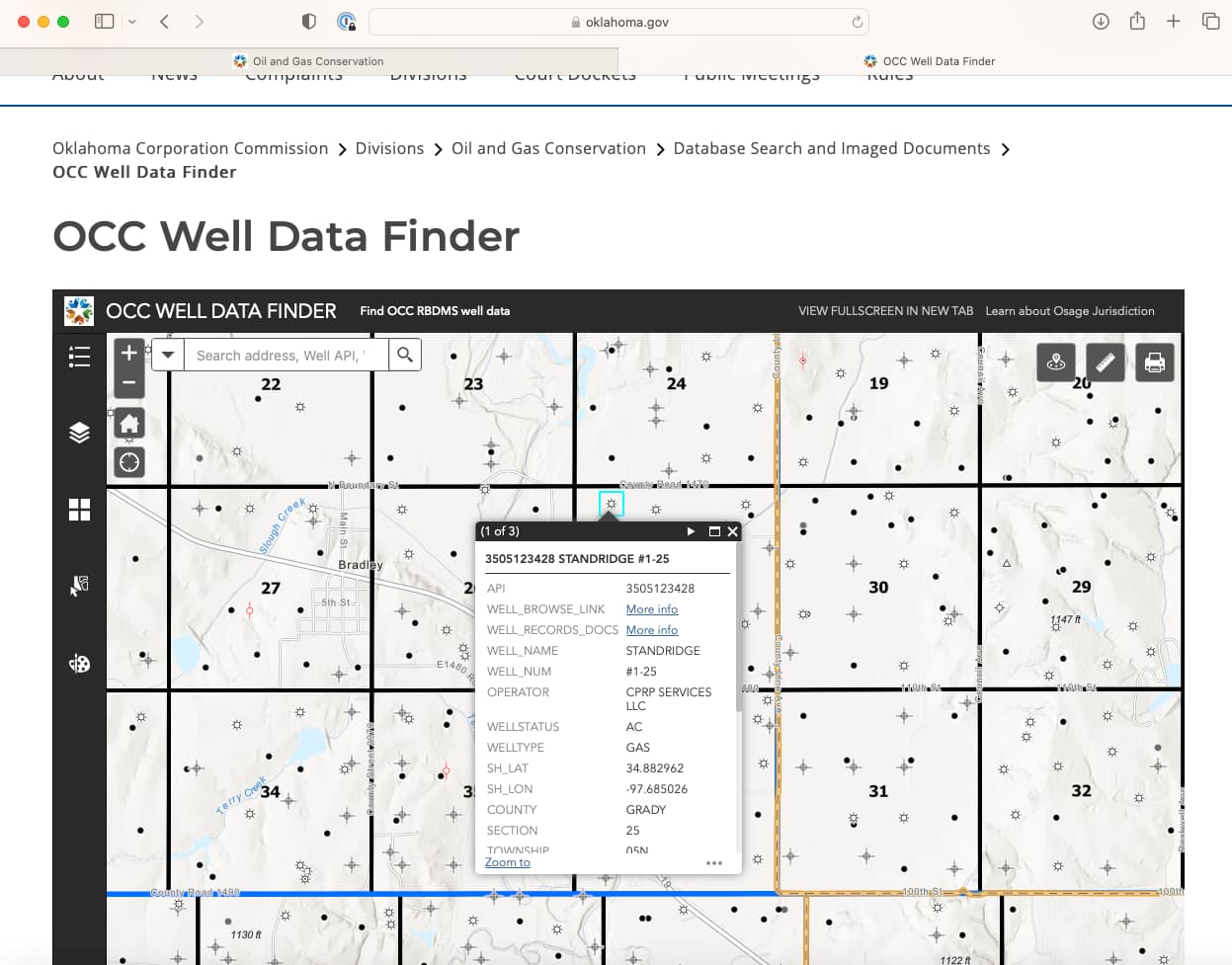
'Click on the well and choose the More Info link to get the docs that go with the wells.
This is the example for the Standridge well. Your acreage has to overlap the spacing in order to be paid. Click on all of the vertical wells to check them. You also have a potential well bt Red Rocks Norvill A 2-36. Surface location in 36 horizontal well. API 35

1 Like
This topic was automatically closed after 90 days. New replies are no longer allowed.