Can anyone tell if I’m making the correct assumption that I’m entitled to mineral rights in the Joie #1 well (lease #246391, API 203-34629) in Harrison Co, TX? I have interests in adjacent surrounding wells (listed below) that are all in the same William Smith Survey A21 on the RRC map. I’v never received a Division Order on the Joie well and only recently discovered it’s existence on the RRC website. Enpower Resources is the current operator and responded to me “I cannot find you in the division of interest for Joie#1”.
My deeded interest is “TRACT NO. 1: A part of the William Smith Survey in said County, and being 305 acres of land, and being the same land described in the deed of W. S. Anderson to George Lane, dated December 19, 1871, which is recorded in Vol. X, page 723, Deed Records, Harrison County, Texas.” I have the documents and chain of title to this tract.
I have interests in the following adjacent wells that are all in the same William Smith Survey A21 on the RRC map.
Lease # - Lease Name - Well# - (API#)
287286 Callison-Sinclair-Joie #1H (203-35341)
287226 Callison-Joie #1H (203-35335)
245695 Callison #9H (203-34533)
255238 203-01901 BARKER-LENTZ 5H
235397 203-34080 Callison 1
235465 203-34316 Callison 2R
238291 203-34187 Callison 3
243290 203-34486 Callison 3A
236458 203-34370 Callison 5D
242014 203-34367 Callison 8D
246390 203-34568 Callison 11
239115 203-34355 Callison 13D
Any guidance you can give would be SO appreciated!
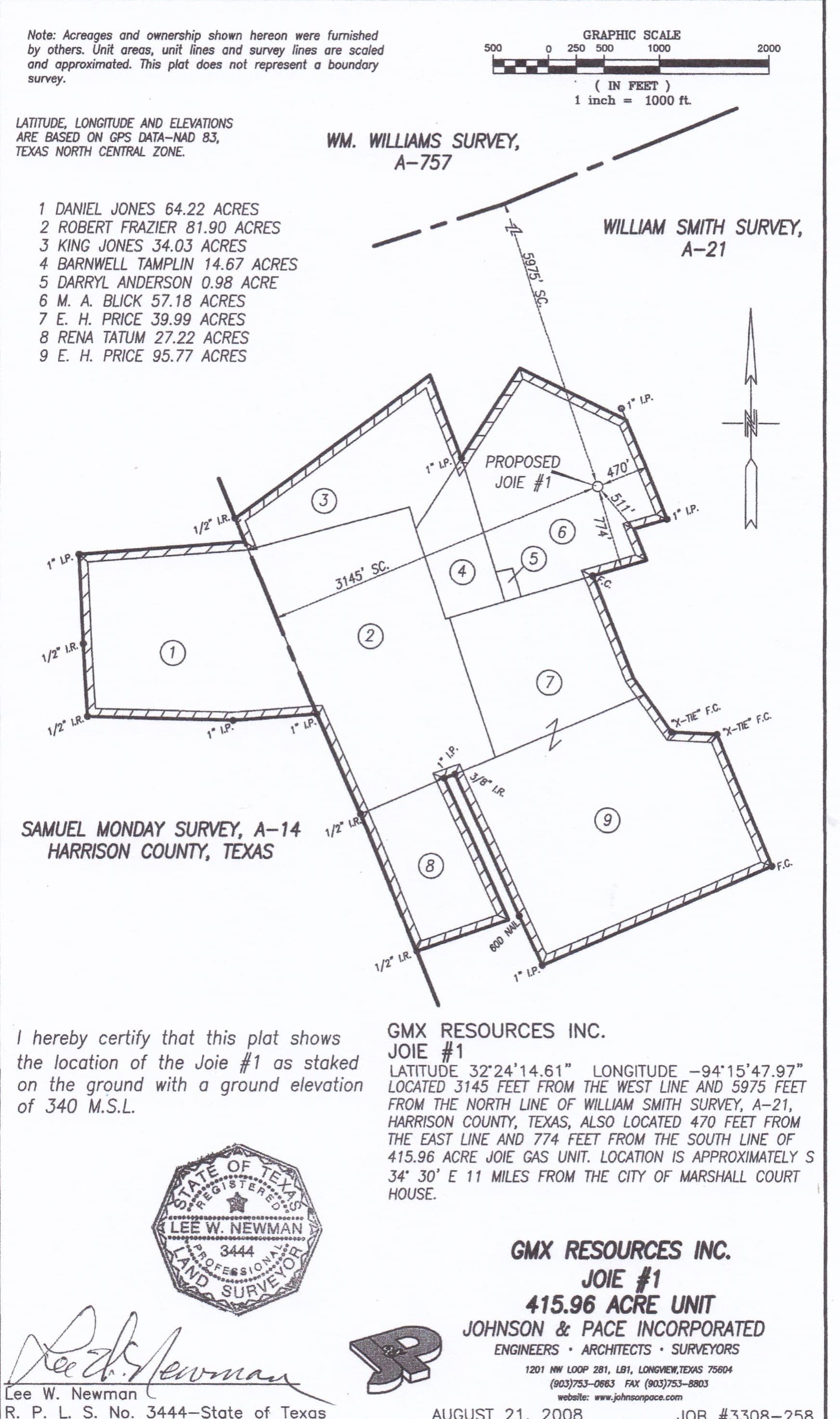
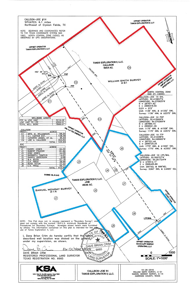
Don’t know if this will help but below is the plat of the 415 acre unit that GMX filed in 2008 when they got the permit to drill the Jolie#1. The plat shows the owner names on the nine tracts that make up that unit. If the 305 acre mineral interest you own includes all, or part, of those nine tracts it seems like you should have been in line to receive royalties from that well.
As you probably know, RRC shows Enpower took over as the operator of the Joie #1 in October, 2019 and reported gas production from it until June, 2023. Nothing was report from then until March and April of this years, and nothing since then.
Linda, after looking at the locations of those other well you said you are being paid on, I think you are going to find your 305 acre mineral interest is further north and east, outside that Joie#1 unit. The Callison-Sinclair-Joie#1 and Callison-Joie#1 wells that you mentioned you are being paid on are allocation wells that included that Joie unit, but it looks like you are included in those wells due to the mineral acres you have in the original Callison unit, not the Joie.
You seem familiar with RRC’s map. If you’ll go to the permits for those two allocation wells and go to the attachments at the bottom of the permit you can pull up those unit plats and see the acreage that was combined to form them.
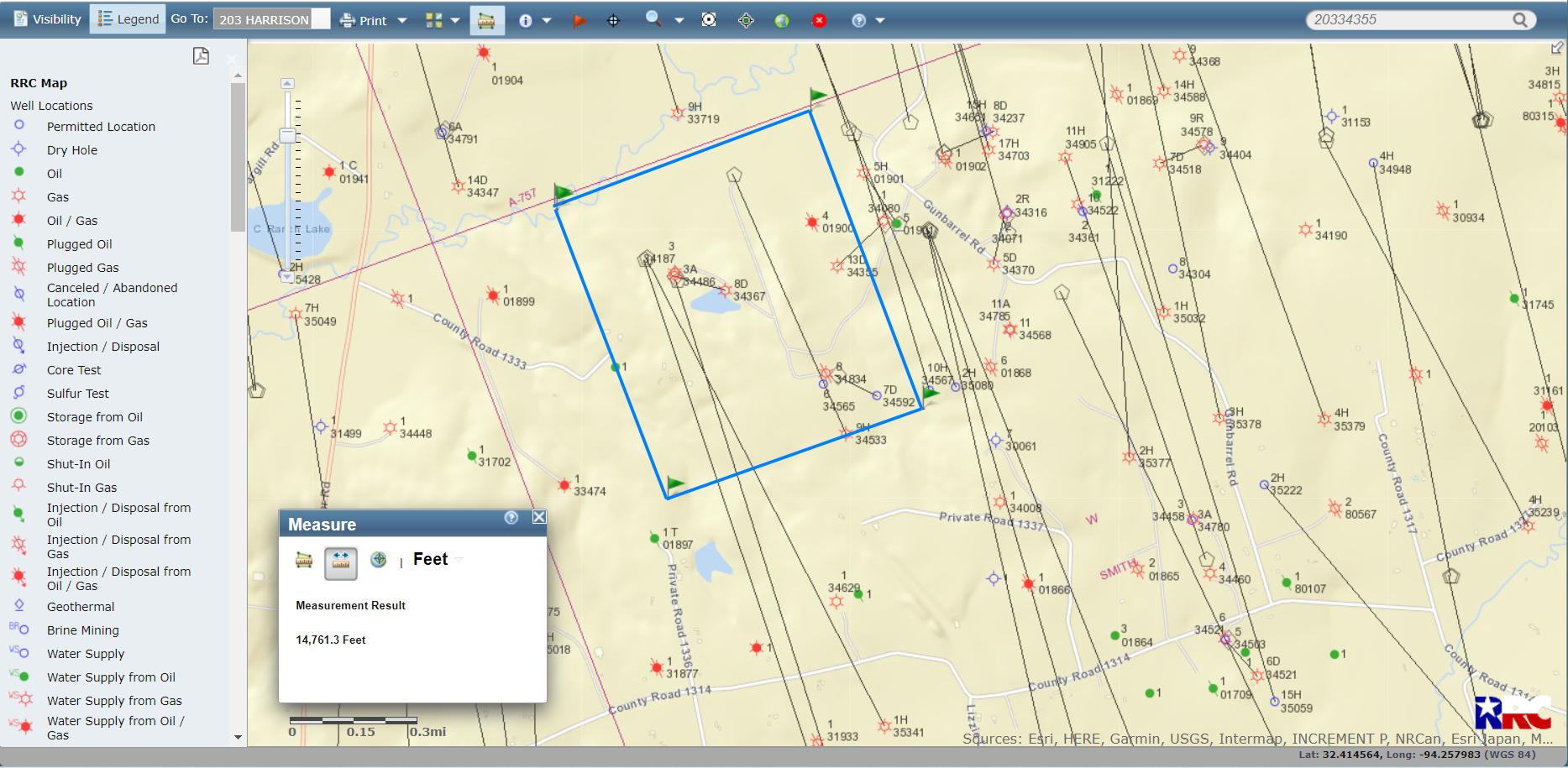
@Linda_Goebel, as @Dusty1 mentioned, it appears your holdings are too far to the North to be involved with the Joie well. The Harrison County documents are available online, and I was able to read one of the property lines was south of the North line by 240 rods (3960 ft). The other references are to old property owners, so I can’t definitely say how far east your property goes, but it doesn’t appear to include the newer Comstock Allocation wells so I drew
an estimated area on the picture below. (Blue Rectangle with flag corners)
Hi Dusty - I’ll pull up the unit plats and see if I can figure them out - thank you!! By “allocation wells” do you mean that Callison-Sinclair-Joie#1 and Callison-Joie#1 have some acreage in the Joie section, but I’m getting paid beause my rights are in the Callison section?
Hi PeteR & @Dusty1 - I have a few plat maps from the old division orders and leases that I can review. I’ll compare them with your attachments. I’m a rookie with digging into RRC, so appreciate all your help so much. Wm. Smith Survey Map2 1.pdf (4.8 MB)
Wm. Smith Survey Map1.pdf (930.3 KB)
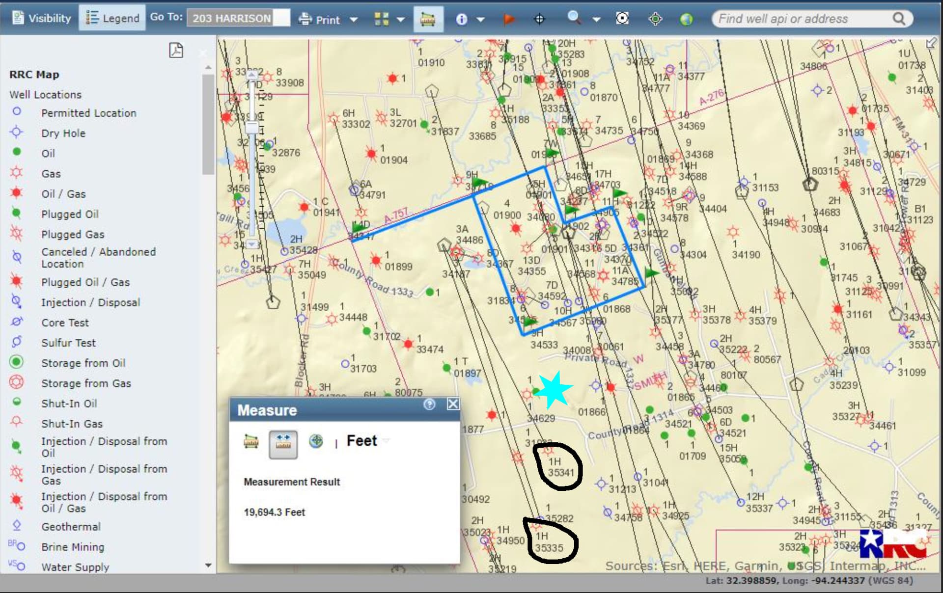
@Linda_Goebel, those drawings are quite helpful. It looks like your mineral tract corresponds closely to the surface tract shown on Harrison County CAD. Another sketch of your tract on the RRC attached. As @Dusty1 indicated, your holdings look like they are a little north and east to be included in Joie 1.
@PeteR & @Dusty1 - I noted on Peter’s map that Callison-Sinclair-Joie (35341) and Callison-Joie (35335) are south of Joie (34629) and my outlined acreage, although I’m receiving royalties from them. Do you think it’s the allocation logic that’s keeping Joie out of the mix? This is my actual dilemma.
In case you weren’t able to pull it up on RRC below is the plat showing the boundaries for the Callsion-Joie unit. The original Callison unit is outlined in red and the Joie unit in blue. I’m guessing your mineral interest is the 300+ acres at the northeast corner of the Callison unit that is labeled C4.
If you pull up the plat for the Callison-Sinclair-Joie unit it will look very similar. just include the acreage in the original Sinclair unit along with the Callison and the Joie.
You receive royalties from those two allocation units based on the mineral interest you have in the Callison unit, but since you’re acreage isn’t within the boundaries of the Joie unit you don’t receive royalties from that original Joie well.
There are different type allocation units, some where production is allocated based on the acreage each original unit makes up of the total acreage in the allocation unit. In other cases the allocation is based on the portion of the producing lateral in each original unit. The method that’s being used on these wells should be documented in division orders or production sharing agreements you signed.
To learn more about them trying using the Looking Glass feature at the top right side of this page, putting in a key word, like allocation wells, to find previous posts discussing them. There are lots.
@Dusty1 - thank you so much for the combined map. You’ve pulled all the pieces together and it makes so much sense to me now! Thanks so much to you and @PeteR for your help.