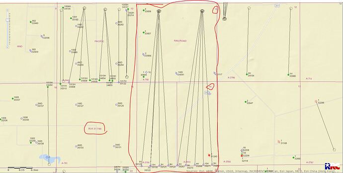
Any actual drilling going on in Sections 11, 14 and 24 Block 51 T8S Reeves County, Texas?
No sure about the ‘actual drilling’ but Chevron has 10 approved permits for wells beginning in Section 11 and ending in Section 14…those wells were approved in April and May 2021. I see no activity or permits for Section 24.
LEFT CLICK ON MAP TO ENLARGE
Question from a dummy: Why would they drill that fan shaped pattern, when it would seem to make more sense to make them parallel. Aren’t they missing out on a lot of oil up in the vicinity of the well heads?
Economics…and by using the same pad they are not destroying so much surface land…and those open spaces can be infilled at a later date…I’m sure they have a plan to get as much of the oil/gas as possible.
DRILL BABY DRILL
Makes sense I guess, thanks. I have a couple of wells that are parallel to each other and they were drilled from the same pad. I think they went East and West then turned South in order to get the full length of two sections with parallel horizontals.
The shape of the laterals RRC shows on their map match the general direction but not the actual path of the horizontal legs of the wells. If you look at the plat the operator filed with the permit application you’ll see that when the vertical hole reaches the programmed depth they typically make a turn before starting the lateral section so the horizontal sections of wells that appear to fan out from the same drill site actual run parallel.
Thank you so much. This clears it up nicely.
Alot of times, when they actually drill the laterals will go out then down. These lines are just drawn from the pad site to bottom hole location.
This topic was automatically closed after 90 days. New replies are no longer allowed.
