What should I expect for an increase density order to allow the drilling and production from an additional well on the drilling and spacing unit on a piece of land I have a royalty interest in? This has been proposed before the corporation commission of the state of Oklahoma.
Please give a section, township and range if you want a more accurate answer.
Generally, the increased density case is filed with the OCC which will set a hearing date. The geologists and engineers from the operator will present their proof that the first well(s) cannot adequately drain the reservoir and they will recommend how many more wells it will take to adequately drain the area described. The commissioners will make a ruling and then time will tell as to when the operator may start drilling more wells. Not much was drilled in 2020 due to lack of demand and low prices. Depending upon the area, I am seeing an uptick in drilling plans for later in 2021 and into 2022. You can monitor the cases in your section and any permits on the OCC website. Do you need the links?
Thank you Martha! I appreciate the reply. The section-township-range is 12-13N-6W.
Your hearing for increased density has a date of 8/10/21. Red Bluff also has a location exception hearing the same day. They are requesting one more well. If the Location Exception is granted, then the permit may follow shortly(?) thereafter. The permit will have a time frame on it, so that will give you a time frame and what type of well they plan to drill and to what reservoir. They may or may not drill it, but that will be dependent upon too many factors to name.
In OCC order # 718517, on May 3, 2021 XTO was authorized to drill another well in 3-6n-13e. How do I learn if/when a permit was issued? Under well data, a named well has to be clicked on to get such information, but this has no known well data on which to click. Thank you.
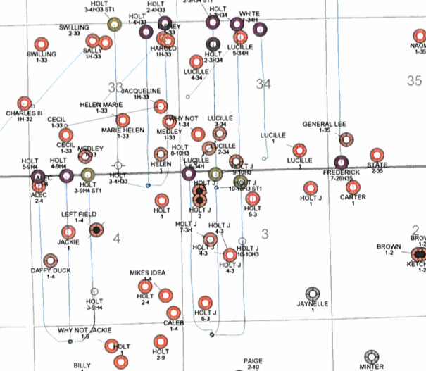
If you look on the documents that go with the order, the map shows the surface location is actually in section 10.
The proposed well
So since the well looked like it might be drilled from section 10, I went to the wellrecords site and used 1006N13E in the location box.
Test. Now I see both 9-10H3 and 10-10H3 which have been completed. 1002 is the completion report.
1000 is the permitThis topic was automatically closed after 90 days. New replies are no longer allowed.


