Trying to locate details on a few wells located in Pontotoc County OK. Not sure if they are active, plugged, lost in paperwork somewhere. I have found a section map but it does not show these ranges as reference, they have been in the family since 1988.
This is how they are written on the deeds
#1 is NE/4 section 17, township 4 north, range 7 east
#2 is sw/4, sw/4 and the se/4 nw/4 sw/4, section 8 township 4 north range 7 east
#3 is se/4 of the ne/4 section 4 township 3 north, range 5 east
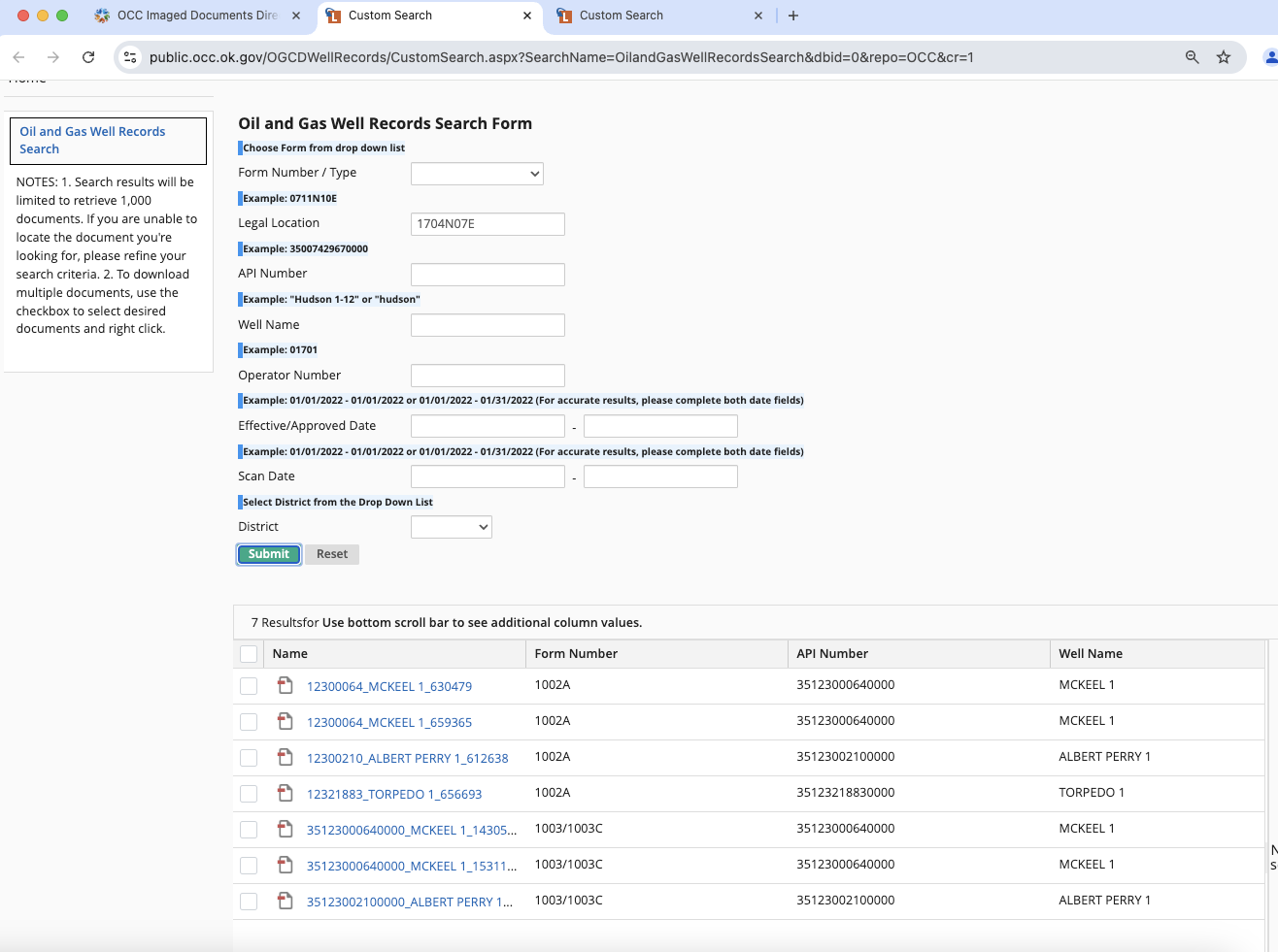
Scroll down to Help, click “Public Pun Search”
When the page opens, scroll down and click the search by legal button. Click it then enter your legal descriptions. Note, Sections require 2 digits (eg 08 for 8) Likewise the township and range require 2 numbers plus the direction (eg. 04N 07E). I usually leave the Quarter blank. Then pull up the wells. If you see an active one click the link, then click printable which will show activity over the past 12 months.
This post is not legal, tax or investment advice. Reading or responding to this post does not create an attorney/client relationship.
Thank You for your help, I am new to this, my grandfather handed them to my dad who in turn handed them to me in 2020. I have one in Coal County that is still producing currently.
I did as shown and found the info, I am to assume that once the area is dry, that they will not do any drilling in those areas again? Or do I need to keep a yearly search of the areas to see if any new productions occur.
Also is there a way to know which wells are in the mineral deeds that I have or are they all included in the deeds? Meaning any well in sw/4, sw/4 and the se/4 nw/4 sw/4, section 8 township 4 north range 7 east- all wells in SW4 would be in the deeded area I have?
Drilling tends to come in cycles depending upon technology and price of oil and gas. It depends upon what the geology is. Certain parts of Coal have had several cycles, first with convention drilling into typical reservoirs and then later with horizontal wells. Make sure you have the probate documents filed in Coal county and your correct address on file with the county clerk of deeds so that any land man can find you if there is new interest. Operators will send out the OCC cases to the addresses on file if there are new wells pending. It is a good idea to just check once a year to see if something is happening.
The wells are not “included” in the mineral deeds per se. Each well has its own spacing so you would only get royalties if your deeded acreage is included in the spacing of a well. For example, most shallow oil wells are at 80 acre spacing. If the well in in the W2 of the NW4 of a section and your acreage is in the SE quarter, then you would get no royalties. But if a well has 640 ac spacing, you would be included in the royalties.