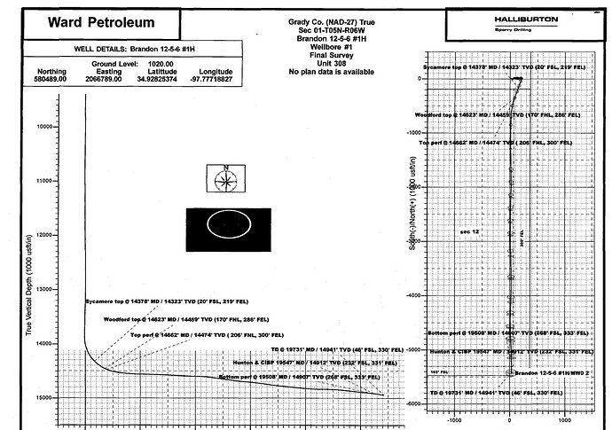
I asked this similar question a few months ago but wondered if someone could please give me a clearer explanation? The response from the operator was limited.
Currently being paid on mineral interests in two wells in Sec. 1, T5N, R6W, Grady County. Mineral deed is for NW4 of SE4 and SE4 of SW4 of NE4 and N2 of SE4 of NE4.
There is a third (horizonal) well - Brandon 12-5-6-1H - and the general lease legal is the same. It also appears that the horizontal surface hole lease includes the SE4. When I contacted the operator, Camino Resources, they said the well was in section 12, which is the bottom hole lease legal, so that is why my mineral interests are not included.
I’m just hoping one of the many experts on this forum could help me understand how the process works, as I am guessing there will be more horizontal drilling in Grady County.
Thanks so very much!
