Does anyone know the surface rights owner of this in Fayette county Texas?.. John Dalrymple Survey, A-166. The last name posted here might be misspelled. Thanks.
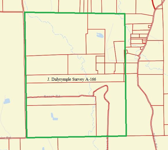
There are a bunch of different surface owners in that survey. Below is Fayette County Appraisal District’s map showing the different parcels.
You can find the surface owners of each tax parcel from the interactive map on FCAD’s website. Here’s the link that should get you there. https://www.fayettecad.org/interactive-map
On the first page click that you agree to their rules and on the next page that opens use the search box at the upper left side. Type in the name Bowers and the first name that shows up on their list of accounts will be Bowers HR Investments. Click it and you’ll see they own the 343 acre tract that’s at the northwest corner of the Dalyrymple Survey. You can click any other parcel on the map to see the name and address of the surface owner.
If it doesn’t work for you post the general location in the survey of the part you are trying to identify.
Thanks, Dusty1. This will help a lot.
This topic was automatically closed after 90 days. New replies are no longer allowed.
