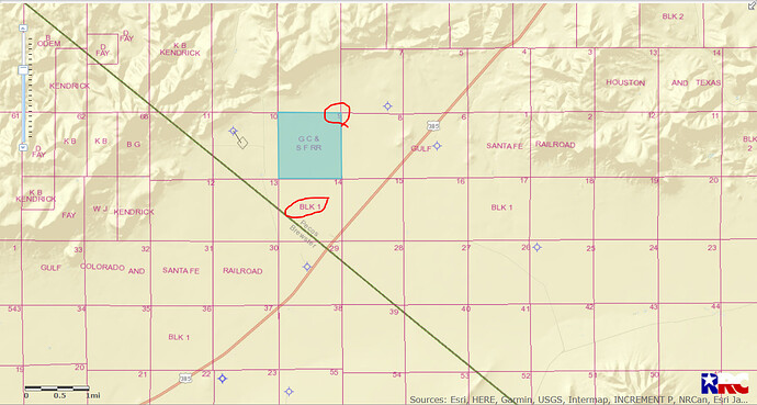
I own mineral property in Pecos County and I’m having trouble locating it on the RRC GIS viewer or the GLO viewer. The legal is: Section 9, Block 1, Fort Stockton Irrigated Land Company Subdivision including tracts 33-48. I think I may have found it just NE or Ft Stockton, but would appreciate someone confirming the location. The block layout in Pecos County isn’t as easy to navigate as Reeves. Thanks.
Daniel I find your mineral acreage about 30 miles South of Ft. Stockton. No activity or production in or nearby that area at this time. GIS(Geographic Information Survey)map of Pecos County Section 9/Block 1/A-2023:
CLICK ON MAP TO ENLARGE.
Clint Liles
That is about where I thought it might be. Not much going on in that part of Pecos County, unfortunately. I appreciate your help!
Daniel…your land is south of Fort Stockton off the road to Marathon, Tx. Be advised there will soon be major developments in that area as they explore and expand the footprint of the Delaware Basin.
, Reeves county, Tx ![]()
![]()
![]()
![]()
1 Like
…thanks. I’m cautiously optimistic that holding on to this land for many years may eventually pay off.
