The document on okcountyrecords does not list the full legal description. It just sets up the trust and beneficiaries. I am attaching it.
Here are some other documents that may help. The Division Order actually lists her acreage, but they missed a section number on Tract 15. She probably owns a portion of Lot 2, Section 5-19N-2W and Lot 1 Section 5-19N-2W. These are actually in Logan county, so you need to file there. See if the Division Order says Logan for that section. That is what the county wants. See the screenshot near the bottom for her complete acreage in the section. I found it on a lease. The lease will list the gross acreage, not her net. Your mom will have some lesser net acreage since she is splitting with her sister.
The unitization agreement is attached with a map and the description of the tracts. Your mom and her sister’s name are on the respondent’s list. Save this document. The original wells were O. Bulling and Bulling A/B which were added to the complete waterflood list. (The 32-20N-2W is just where Tract 1 is, commonly used as the “address” for the waterflood.). Phase I and Phase II are frequently used as project timing items-not the name of the wells. They will do XYZ in the first phase and PQR in the second phase. Sometimes the decimal amounts will change because tract participation amounts will change. In a waterflood, many wells are combined under one operator who is responsible for getting the best production out of the field by various secondary recovery methods. Sometimes, your original well is no longer productive or will be turned into an injection well, but you will still get paid on all of the other productive wells in the field.
Looks like the wells were transferred from Mid-Con Energy Operating to Contango Resources, 717 Texas Avenue, Ste 2900, Houston, TX 77002 in 2020.
trust Noble (watermarked) - Book 000523, Page 0552-0553.pdf (97.6 KB)
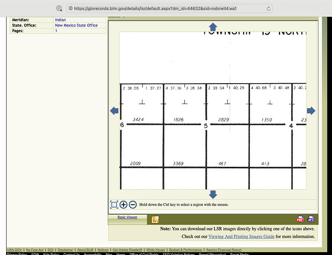
Here is a map of Lot 1 and Lot 2 5-19N-2W. They are the North Half of the Northeast Quarter of section 5. The northern and western sections in some townships are not exactly 640 acres due to the curvature of the earth, so the irregular lots are designed to compensate for that. Lot 1 is 40.29 acres and Lot 2 is 39.34 acres.
You may need to do some further detective work as okcountyrecords lists quite a few tracts that Ann Marguerite Snell owned. If she had those tracts in her trust, then your mother may own other acreage. It would be worth it to join okcountyrecords.com for a month and download everything you can find under her name. She had holdings in Hughes and Logan. I see a deed for Hughes, so that is probably gone. Since Ann was signing leases in her own name until 2017, she may not have transferred the tracts into the trust. You will have to do some hunting. Do you have her probate docs? They are probably filed in Washington.
Looks like she also owned the SW4 of the NE4 of section 5 and the S/2 of the NE4. I am finding it on some leases. Here is the description that the county will probably need if it matches the aunt’s will or trust documents. (I am not an attorney, so not giving legal advice.)
.
All that being said, the waterflood is probably at its end stages. The S/2 NE4 and SE4 do not have any wells, and are not in the waterflood, so no royalties. You may have to contact Contango for the Lucien field and possibly D&J Oil Co for the Glockler 1-23H well which goes from section 32 south into sec 5. I am also seeing Crescent Energy as the operator for several wells. Not sure if they are in the waterflood or not. if there is not much production, you are not going to see a line of buyers show up.

