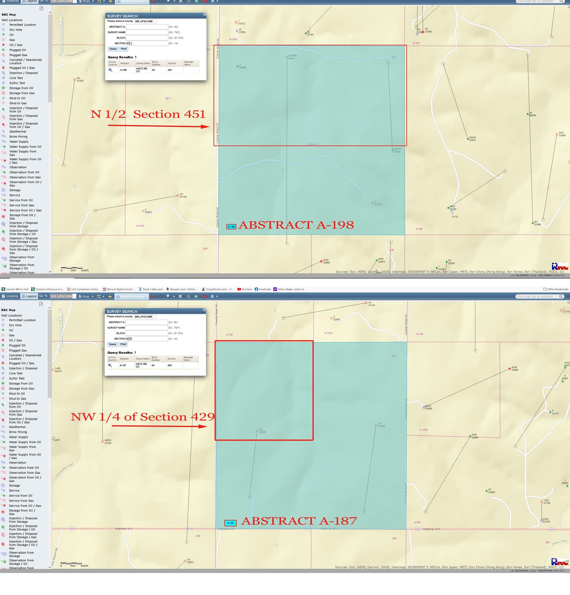
I am trying to determine activity in the following two areas we own in Lipscomb County:
Northwest quarter (NW 1/4) of Section 429, Block 43
And
North half (N 1/2) of Section 451, Block 43
We are getting a lot of inquires and offers, and I want to track the activity in this area. It appears Revolution Operating and Urban Oil & Gas might be operating here.
Thank you! I see the legend on the side, but how do I obtain further information? For instance, on 451, I see two horizontal wells. Can I further search these?
Use the API# which is the county # and the well # combined to get the well highlighted. Then left click on that and use the the drilling permit dropdown to get to the next menu. You can then click on the lease name there for the w1 file.