Good evening, I’ m trying to determine the value and any immediate activity in this area. Offers have been $1,500 per nma to lease & $10,500 for outright sale. I’m unable to figure out how to identify the scheme used for sections/blocks to pinpoint locations. Thanks for any assistance
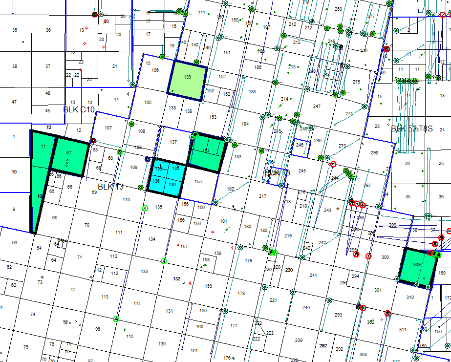
See if this looks like the right area. For some reason Section 133 isn’t marked on the map but that highlighted area is what shows up when you search for that block and section on RRC’s map.
If that is the right area it looks like there was considerable new activity nearby last month. Apache filed the permit for that well in the section to the west, called the Storm Cat Unit, and Primex filed permits for the two wells in what they called the Pease Unit that’s in Sec. 134, the next section to the north of 133.
I get the same scenario on my 1945 map, Dusty. I’d love to upload image, but can’t seem to get there from here. I’m no big fan of new web site. Linton
That’s the right location for Sec 133. And yes, a few new permits nearby. I’m not sure when anybody will get around to drilling your section. There is just sooooo much undeveloped acreage in SW Reeves that nobody is going to get it all drilled anytime soon. Hence low offers.
I’d just lease it. You can always sell the leased minerals later if so inclined. Those random highlighted tracts on this map are things that I know somebody was trying to market at >$10k/NRA in the last 6 months. Which I don’t think anybody paid, but I still wouldn’t be selling your stuff at $4-5k/NRA (lease of $1.5k plus two NRA @ 4.5k/each = $10.5k).
Many thanks to Dusty 1 & NMoilboy for the responses, maps, and guidance.

