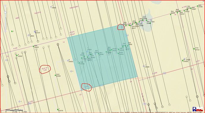
Does anyone know where I can find Sec 13 block 33, township 2n on a map?
Having your payment stub/property tax bill handy, go in the RRC website here: http://webapps2.rrc.texas.gov/EWA/drillingPermitsQueryAction.do When you find the field or area you seek, you should find a hyperlink to the map of just the one section. Hope that makes sense!
Mark use this link to RRC GIS Public mapping system…
http://wwwgisp.rrc.texas.gov/GISViewer2/
GIS map of Howard County Section 13/Block 33 T2N/A-324:
DOUBLE LEFT CLICK ON MAP TO ENLARGE
Clint Liles
Thank you, I appreciate you sharing your knowledge
I have mineral interest in this same section. And have plenty of information regarding recent activity and changes pertaining
Do you know how many people total have mineral rights in that location?
I can email you an entire list of all interest owners in the section from an old division order. What’s your email
