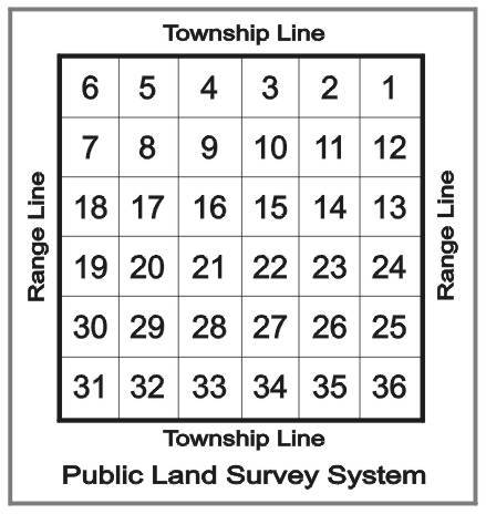
Here is a standard" township plat map with the thirty-six 640 acre sections numbered. This works for any county you are in that has no obstructing features, such as rivers. Those townships will be ":irregular" and you will have to find that particular plat to see just how everything is numbered.
If you want to see the bigger picture, draw four of these plats together and then you can see what is going on in a twelve mile square (each "regular" section is one mile square, the entire township is six miles square
Hope this helps. There are tons of places on the web with good tutorials about this kind of stuff to help you become a better informed land/mineral owner.
