My family just received an unsolicited offer to lease our 20-odd acres out of a 751-acre area in Upton County (Section 8, Block 2, A-832, Mary Smith Survey). 25% royalty, bonus of $500/acre for 5 year term with another $500 for 2 year extension. The landman is from Texala Energy LLC and is working for David Arrington Oil & Gas Operating, LLC. I’m new to this and would like to know how active the Upton County area is right now, whether these terms are reasonable, and whether the leasing entities are reputable.
The founder of the eponymously named company is a very successful oilman in Midland, Texas. 3/2 or strictly 3 year leases are far more common. According to the Texas RRC’s Drilling Permits page, 515 wells have been permitted in Upton County, Texas since January 1, 2024. I have no information on Texala Energy LLC, and know nothing about the going rate for bonuses in Upton. Abstract 832 does not appear to mesh with the other components of the description you shared.
AJ11, thanks so much for the help. Sorry for my ignorance but is it the acreage that isn’t right for the section, the block or the Abstract 832? What doesn’t mesh?
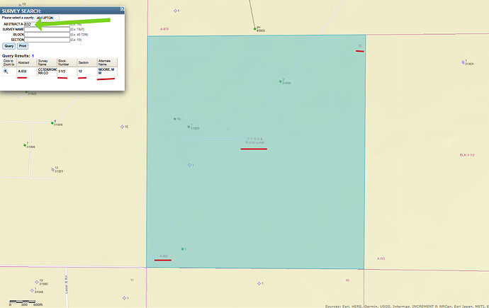
I entered 832 and Upton, respectively, in the Abstract and County fields of the RRC’s Map Viewer and the highlighted parcel on the map was not Blk 2, Sec 8.
Not to mention Blk 2 Sec 8 is covered with Hz wells. I don’t think either location (Blk 2 Sec 8 or A-832) is in the Mary Smith Survey.
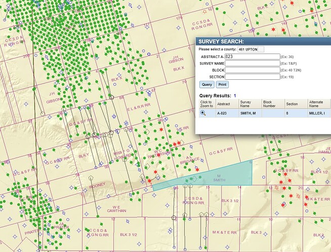
I think its A-823. Shrug. Could be wrong.
Dang, I’m embarrassed. You both are spot on. The email from the landman had A-832 but the lease had A-823. Thanks for pointing me to the RRC’s Map Viewer where it looks like there are three oil wells, some activity to the north but almost none to the south.
Slide over 1/2 mile to the west east of your section and see that a vertical well was permitted April 2024 https://webapps.rrc.texas.gov/DP/drillDownQueryAction.do?name=SCOTT%2BTHOMAS&fromPublicQuery=Y&univDocNo=497185885
What an education I’m getting. I can’t thank you enough. AJ11, you tricked me by pointing me 1/2 mile west but I couldn’t find the newly permitted well until I searched the API (from the link you provided) and it was 1/2 mile east. Now I understand the legend and found another permitted well about 1 mile south at the very north of A-112 (API 46139497). It was approved way back on 6/11/14 but isn’t listed as a dry well because it was never drilled? Does that happen much?
Maybe the legends aren’t up to date. I just checked the 3 oil wells in A-823. One is listed as plugged while the other two are not but they were approved and drilled back in 1983 and 1985 and went down 9,500 feet. Is there a way to know whether they ever produced? Seems like they should be listed as either plugged or dry?
Sorry about my error, now corrected. I don’t think it is uncommon for a permitted well not to be drilled, and wells can be drilled but not completed in a timely fashion, called “DUC” wells.
Along the top Map Viewer bar, click on the “Identify” blue circle tab and choose “wells” from the drop down menu. Then center your mouse over the well of interest and right click. This will create the pop up with the permit and other information. Scroll down inside the pop up and click on each “production data query(pdq)” entry. As a default, you might sample all the way back to 1993 just to make sure you get as accurate a production report as one can through the RRC’s online portal.
Super helpful as usual. Now I just gotta figure out how to buy you a case of beer or a bottle of bourbon…
This topic was automatically closed after 90 days. New replies are no longer allowed.

