I’ve inherited mineral rights for 160 acres located at location: The Southwest Quarter (SW1/4) of Section Thirty-six (36), Township One Hundred Fifty-eight (158) North, Range Ninety-four (94) West, Mountrail County, North Dakota. I understand that one net acre is currently producing. Could someone give me an idea of the valuation for the whole 160 acres? Thank you.
I have mineral rights nearby. I think petrohunt or liberty resources is the operator of the drilling spacing unit. That drilling spacing unit is 1,280 acres. It has a horizontal well that is likely paying all mineral owners in that drilling spacing unit.
Do you own 160 net mineral acres or 1 net mineral acre?
Have you spoken with the operator about how many mineral acres you own?
Is there a dispute between you and the operator about how many net mineral acres you own?
You can get a copy of the mineral deed from the mountrail county land records office.
Verifying your ownership of your mineral rights is the first thing you should do.
Then you could contact the ND oil and gas division and ask them for the exhibits of the docket case for this drilling spacing units. This will tell you the # of wells that could be permitted in this drilling spacing unit. Your drilling spacing unit is between two drilling spacing units that have successful wells. I think you will see more drilling in the future.
The docket exhibits show plans about your drilling spacing unit, estimates for the wells. The exhibits were filed before the horizontal well was drilled.
I think these drilling spacing units will get more wells as the price of oil increases or even stabilizes around this oil price. You can talk to the company landman about their plans.
I would do these things first, before trying to sell your mineral rights.
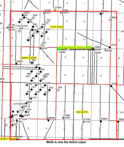
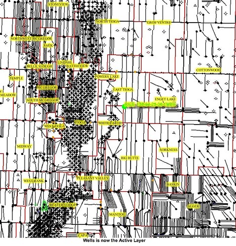
That section has one well the Rice 158-94-25-36-1MBH which was drilled in 2017 and came online in 2018. The surface location is in 25. Liberty Resources Management is the operator. The well is fairly new and room for more wells in the future (no promises, just commenting that due to the placement on the far west side of the sections, they left room. Note that sections 30 & 31 just to the east and 29& 32 already have two wells each. Zooming out (second picture) shows where the infill drilling had been. Your well is in green.
At the top of the page is a Directories Tab. There may be appraisers in the list that can help you. Do your homework on the operator first as that is free.
Dear shamlet76, Thanks for the information. My brothers and I own 160 acres of mineral rights.
Dear M_Barnes, Thank you for the information.
This topic was automatically closed after 90 days. New replies are no longer allowed.

