We have a tiny acreage in Grady County that we inherited and did not know about. We have been approached to sell the rights. I need to know where the land is in relationship to other development in Grady. I have used the gis map cited in another group to find Grady and what appears to be numbering similar to the purchase letter. I am confused by what the 5 refers to in the designation 5-4N-7W in Grady County.
Thank you for any replies.
The number five is the Section number. Section 5 Township 4N Range 7W.. There are 36 sections . Think of a checker board with 6 squares by 6 squares. Number one is in the upper right corner and goes across then down one lever and back. So section 12 will be under section 1. and so on.
There are many more people on the forum that are better informed and will most likely jump in and help out.
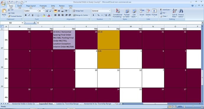
Your section is about 4 miles North of Rush Springs with Highway 81 running through it. The North-East corner of the section touches 33-5N-7W where EOG Resources has gotten approval to drill a horizontal well. EOG has not yet requested the Permit to Drill, but that very likely will be their next step. I counted 59 Oil & Gas Leases in your section, which is quite a few. Your section may be getting a well sometime in the future. Probably why you are getting those offers to purchase your minerals.
